Using drones within archaeology
Posted on by Fay Curtis.
Sam Boyle, Community Archaeology Trainee
 Hi! I’m Sam and I work with the Archaeology collection at Bristol Museums, Galleries & Archives, engaging young people with archaeology. Recently I had the opportunity to observe an unmanned drone survey of the Iron Age Hill Fort on Clifton Down in Bristol.
This technology has many applications across archaeology and heritage. It gives archaeologists the opportunity to locate lost cities, create virtual reality environments, 3D models of ancient and scheduled monuments, hillforts and buildings as well as surveys of the condition of our ancient monuments. The maps and models can also be used to engage the public with historic sites and in learning sessions with children. Prehistoric monuments which are not readily accessible can now be surveyed and a 3D model created for use in learning sessions with schools.
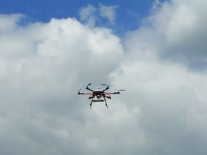
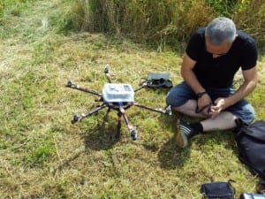 The survey was conducted by Stephen Gray, a Senior Research Data Librarian with the University of Bristol. He’s studying for a PhD in Archaeology & Anthropology that relates to the way that digital media technologies might be used to help safeguard local heritage. After double checking that the correct flight programme had been loaded onto the drone and a final Health & Safety check, the drone, powered by propellers, gracefully rose from the ground. Stephen told us that his drone can fly at a maximum height of 2km, although for this survey, the drone only needed to fly 40m above the ground.
As the drone is unmanned and has a pre-programmed flight plan, the operator only needs to monitor the drone’s progress. From the side of the Hill Fort, we watched as the drone hovered above the ground taking approximately 150 photographs. I was surprised and impressed at how smoothly the drone hovered and with how quickly the aerial photographs were taken – the drone was only flying for 3 minutes.
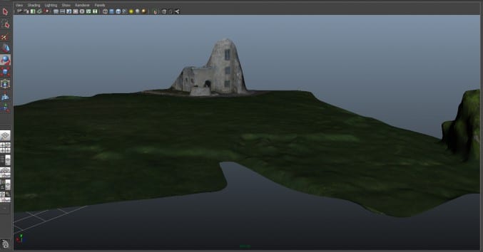
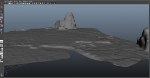 The next stage of the process uses a computer and takes a little bit longer. All of the aerial photographs taken during the survey are downloaded and run through computer software to create a 3D model and map of the landscape. This process gives us the opportunity to see the landscape in greater detail, as well as highlighting features in the landscape which may not have been recorded in previous topographical (land) surveys or even seen before. These images show what the resulting map looks like in the computer software – you can also take a look around the 3D map yourself (you’ll need to have an up-to-date browser).
Unmanned drones are being increasingly used within archaeology across the world and the technology has been developed by radio controlled model hobbyists. The drones have been used as tools to conduct aerial photography, regional surveys, site identification and mapping as well as 3D modelling and creating virtual reality environments.
Similar drones have been used with great success in Peru to map sites from the 1300 year old Moche civilization (pre-dating the Incas). The ruins of Moche cities have deteriorated to such a level that the remains can barely be seen, but using unmanned drones to take aerial photographs has resulted in 3D models and maps being created. The position and the layout of the cities can be seen for the first time in centuries.
3 comments on “Using drones within archaeology”
Pingback: Archaeological drones | Computational Archaeology
I belong to a local history group which would be interested in voting time and funds to doing something like this. Is this a possibility? Could we become part of a scheme?
Hello Kevin
there are some drone companies who are licensed to undertake paid archaeological survey work however it might be worth contacting Stephen Gray at the University of Bristol as what you suggest may be something he would be interested in from a research perspective, His contact details can be found via the University website ( Google ‘Stephen Gray University of Bristol’). You may also be interested in reading the guidance notes he has written and these are published on the Archaeology Data Service website – links can be found in this blog piece: http://archaeologydataservice.ac.uk/blog/2014/11/archaeological-drones/